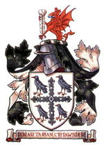
The current administrative area of Flintshire (a unitary authority) came into existence in 1996, when the former administrative county of Clwyd was split into three smaller areas.
Geography
It borders, in England, Merseyside (across the River Dee) and Cheshire, and in Wales, Wrexham and Denbighshire.
Places in the principal area include: Traditional Flintshire
The traditional county does not have the same boundaries as administrative Flintshire; in particular it has a large exclave called Maelor Saesneg, it also includes Prestatyn, Rhyl and St Asaph which are now administered by Denbighshire, as well as Bangor-on-Dee administered as part of Wrexham county borough. The county was formed in 1284 under the terms of the Statute of Rhuddlan and included Cantrefi formerly parts of Gwynedd Is Conwy and Powys Fadog: It also included the Lordships of Mold, Harwarden, Mostyn and Hope.
Flintshire is a maritime county bounded to the north by the Irish Sea, to the northeast by the Dee estuary, to the east by Cheshire and to the south and southwest by Denbighshire. The enclave, Maelor Saesneg, was bounded on the northwest by Denbighshire, on the northeast by Cheshire, and on the south by Shropshire. There is a further small detached part around Marford.
Flintshire is the smallest county in Wales. The coast along the Dee estuary is heavily developed by industry and the north coast much developed for tourism. The Clwydian Mountains occupy much of the west of the county. The highest point is Moel Fammau (1,820 feet). The chief towns are Buckley, Connah's Quay, Flint, Holywell, Mold, Queensferry, and Shotton. The main rivers are the Dee (the estuary of which forms much of the coast) and the Clwyd. The main industries are steelworking, agriculture and tourism.
Places of special interest include castles in Flint, Hawarden, Rhuddlan and Ewloe, and Wepre Country Park, Connah's Quay. | 


