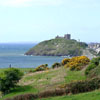
| Llyn Peninsula The Llŷn Peninsula (sometimes spelt Lleyn in English) extends out 30 miles into the Irish Sea from north west Wales, southwest of the island of Anglesey. It is part of the modern county and historic region of Gwynedd. The name is thought to be of Irish origin, and to have the same root � Laighin in modern Irish � as the word Leinster.
Historically, the peninsula was used by pilgrims en route to Bardsey Island, and its relative isolation has helped to conserve the Welsh language and culture, for which the locality is now famous. This perceived remoteness from urban life has lent the area an unspoilt image which has made Llŷn a popular destination for both tourists and holiday home owners.
A survey of schools in 2003 showed that just over 94% of children between 3 and 15 were able to speak Welsh, making Llŷn one of the foremost heartlands for the language, though � as with the rest of northwest Wales � there have been concerns that an influx of English speakers could damage the standing of Welsh.
Geographically, Llŷn is notable for its large number of protected sites � including a National Nature Reserve at Cors Geirch, a National Heritage Coastline and a European Marine Special Area of Conservation as well as twenty Sites of Special Scientific Interest. Much of the coastline and the ex-volcanic hills are part of the Llŷn Area of Outstanding Natural Beauty (AONB), confirming the peninsula as one of the most scientifically important in both Wales and Britain.
Settlements on the Llŷn peninsula include: Hills in Llŷn include: - Yr Eifl
- Gyrn Ddu
- Carn Fadryn
- Mynydd Rhiw
- Garn Boduan
On 19 July 1984 there was an earthquake beneath the peninsula. It measured 5.4 on the Richter Scale and was felt in many parts of Ireland and western Britain; see List of earthquakes in the United Kingdom.
The Welsh Language and Heritage Centre of Nant Gwrtheyrn is situated on the north coast. |