|
Portskewett (Welsh: Porthysgewin) is a village in Monmouthshire, south east Wales. It is located four miles south west of Chepstow and one mile east of Caldicot.
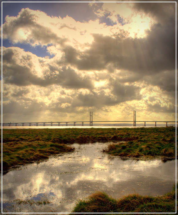
Portskewett is close to the Caldicot Levels on the Welsh shore of the Severn Estuary. The Second Severn Crossing passes overhead carrying the M4 motorway.
History
The name Portskewett is said to derive from the Welsh Porth-is-Coed, meaning the harbour below the wood, or alternatively from Porth Ysgewydd, the port of the elder wood. The harbour is now largely silted up and is known as St Pierre Pill, between Portskewett and Mathern. Portskewett is mentioned in ancient Welsh stories as one of the three chief ports of Wales, and there is a tradition that it was the site of the palaces of the Welsh kings of Gwent before the Norman conquest.
The village church is dedicated to St. Mary. The original parts of the church date back to the late 11th century and are made of local limestone; the carved crosses on the blocked up back doorway could be even older. The church has been restored and altered on a number of occasions. The small windows in the upper part of the tower, for example, are typical of the 16th century. In the corner of the churchyard can be seen the steps which formed the base of a medieval churchyard cross.
From Norman times until 1919, the village was part of the St Pierre estate. It declined in importance after the Norman period and for many centuries it was an agricultural village of no distinction, although it does appear that some iron mining continued near the village until at least the 17th century. In 1662 Thomas Lewis of St. Pierre, lord of the manor, granted the right to mine iron in the manor to Henry Rumsey. By the 19th century the village was in decline. Between 1801 and 1861 the population of the parish, which includes Sudbrook, fell from 216 to 175.
"King Harold's Palace"
The uneven ground south of the church is shown on some older maps as "Harold’s Field". According to the Anglo-Saxon Chronicle, in 1065 Earl Harold of Wessex had conquered the area and was in the process of constructing a building on the site, which he could use as a base for hunting, when it was attacked and destroyed by Caradog ap Gruffydd, King of Gwent. Harold never had the opportunity to take his revenge; in January 1066 he became king of England, and later that year was killed at the Battle of Hastings.
A geophysical survey carried out at the end of 2005 revealed extensive remains in the area. In May 2007, an excavation was carried out as part of the TV programme Time Team. The outcome is expected to be broadcast in 2008.
Black Rock
Black Rock, on the Severn estuary immediately south east of the village, has been an important crossing point of the Severn for many centuries. Numerous coins found in the mud show that it was in constant use throughout the Roman period, on the route between Aquae Sulis (Bath) and Venta Silurum (Caerwent).
By the 18th century, a regular ferry service crossed the Severn estuary from Black Rock to New Passage on the Bristol side, carrying passengers, cattle and iron ore. The Black Rock Hotel served travellers and became a popular local entertainment venue; it was later destroyed by fire. In 1863, the Bristol and South Wales Union Railway built a branch from the main line to Black Rock. Trains would travel out onto a wooden pier, where the passengers would get off before climbing aboard the ferries. The pier was severely damaged by fire in 1881 and demolished after the Severn Tunnel opened in 1886, but parts can still be seen at low tide.
At Black Rock a traditional method of fishing for salmon with lave nets is practised. The fishermen come from local villages and are the last such fishermen in Wales. They are actively promoting the fishery as a tourist attraction, with the aim of maintaining its history and tradition. Demonstrations of the lave net fishing can be watched on certain days from the picnic site at Black Rock.
The estuary has the second highest tidal range in the world, which enables the fishermen to wade out at low tide with nets on shoulders to traditional fishing grounds, with the water up to their waists. The net is then opened and lowered into the outgoing tide which rushes through the net. With his fingers placed at the bottom meshes of the net, the fisherman then waits for the fish to hit the net. The net is made in a traditional way by means of a "Y" shaped structure consisting of two arms called rimes which are made from locally cut willow that acts as a frame work to the loosely hung net. The handle is called the rock staff and is made of ash or willow and the arms are hinged to the rock staff and are kept in position while fishing with a wooden spreader called the headboard.
Heston Brake
At the eastern edge of the village, in a privately owned field opposite Black Rock Road, very near to the Leechpool turn, is evidence of a significant neolithic chambered tomb or long barrow. A small group of puddingstones mark the entrance of the site known as Heston Brake. Human Skeletons, cattle bones and some pottery were discovered in the chamber when it was excavated in 1888.
|

